
Concrete Implementation of General Planning
According to the planning direction, the Red River urban area primarily serves as a flood discharge space for the Red River section passing through the central urban area, as identified in the General Plan for the Construction of Hanoi Capital until 2030 and the vision towards 2050. Simultaneously, it is planned as a distinctive space featuring greenery, water surfaces, historical and cultural elements, and the dominant landscape of the central urban area. Its primary function is to host public structures, green parks, cultural and tourism service entertainment venues emblematic of the capital, catering to festival activities and tourism.
Therefore, the announcement by the People’s Committee of Hanoi City approving this direction, allowing the continuation of studying and proposing the project “Developing the mid-river and riverside into a multi-functional cultural park,” and assigning the People’s Committee of Hoan Kiem District to research the subsequent steps, only amplifies expectations for a nearby green space.
The mid-river area of the Red River possesses considerable potential for developing public and green spaces
Many experts contend that the reclaimed and mid-river areas of the Red River constitute land filled with sediment over many years, covering a substantial area. Over the years, this unused area has been encroached upon for cultivation, farming, and unauthorized construction. Therefore, planning projects aim to efficiently exploit the land fund and inherent potential advantages to create an attractive tourism destination, not only for the capital’s residents but also for domestic and international tourists.
According to Pham Quoc Tuyen, Deputy Director of the Hanoi Department of Planning and Architecture, the planning project for the Red River area has identified the functional zones of each area, concurrently determining the assignment of tasks for the next implementation phase.
In this regard, relevant districts and counties will be assigned to review and study the existing residential areas, based on which detailed plans will be drafted and submitted to the authorized levels for approval, serving as a foundation for managing land use in this area. At present, local People’s Committees are conducting measurements, mapping, and planning. Subsequently, these localities will liaise with the Department of Agriculture and Rural Development to establish the groundwork for plan approval.
Enormous Potential Unveiled
Over the past years, Hanoi has consistently prioritized the construction of public parks, recreational areas, and entertainment spaces for its residents. However, due to various challenges ranging from resources to implementation methods, these efforts have not yielded the desired high efficiency. In the context of ongoing urbanization, where green spaces and public areas are gradually diminishing, particularly in the central core, the utilization of the green expanse in the mid-river and reclaimed areas of the Red River becomes more crucial than ever. This undertaking is eagerly anticipated and widely embraced by the populace.
According to the ongoing survey and research conducted by the People’s Committee of Hoan Kiem District, in the immediate future, the mid-river area will be developed into a multifunctional agricultural tourism landscape. Local households may continue short-term cultivation, yet there will be a planned transition to cultivate suitable short-term crops. This transformation aims to offer visitors the opportunity to explore, photograph, and appreciate the distinctive values of modern agriculture. Simultaneously, the area will evolve into a space for creativity, playgrounds, and basic sports facilities in harmony with the natural terrain.
The riverbank reclamation area will host functions such as green park spaces, short-term crop cultivation areas, and seasonal flower and ornamental tree spaces, coupled with services catering to tourists. Significantly, there will be the development of service areas and sports facilities to serve as community hubs connected with waterfront spaces. This creative space will emphasize the historical and cultural values of the Red River. Additionally, in developing these functional areas, the People’s Committee of Hoan Kiem District is considering the planning of an internal transportation network and pedestrian paths within the mid-river and riverbank areas. This is designed to be environmentally friendly through the use of traditional materials.
According to Architect Dao Ngoc Nghiem, the mid-river area of the Red River holds ample untapped potential to be transformed into a public space. However, during the implementation process, the authorities of the districts need to conduct thorough research and consult extensively with scientific experts and residents to ensure efficient land utilization while maintaining safety, preventing erosion, and flood management. All activities must align with the directives outlined in the Urban Planning for the Red River Urban Zone and the General Construction Planning for Hanoi until 2030, with a vision to 2050, which have been officially approved.
In particular, Architect Dao Ngoc Nghiem emphasizes that the most significant challenge lies in the availability of resources. Investing in such endeavors demands substantial financial backing. Determining how to secure the necessary resources for project development, along with establishing policies that attract investors without compromising the landscape and adhering strictly to general planning, presents a complex issue that local authorities must address.
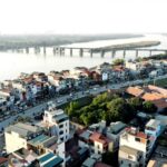
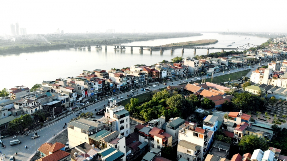
The mid-river and riverbank reclamation area within the jurisdiction of Hoan Kiem District covers an indeterminate area that varies with the annual rainy season and borders three districts: Ba Dinh, Hai Ba Trung, and Long Bien. This area spans approximately 23 hectares, primarily situated in Phuc Tan ward, with 1 hectare falling under the jurisdiction of Long Bien district.
Tuan Dung
Nâng tầm không gian văn hóa xanh Thủ đô (laodongthudo.vn)